The Map Collection contains about 1,000 maps from the 19th and 20th centuries, mostly printed, which can be classified according to their purpose into military, administrative, political, propaganda and tourist groups. The maps include, among others, the 1838 flood map, the city planning map of the Budapest Public Works Council, Pál Teleki's "Red Map", the maps of the border demarcation committee of the Trianon Peace Treaty, or the 1944 manuscript map of the Budapest ghetto from the Jewish Council office.
Contact László Baják, bajak.laszlo@hnm.hu Tel.
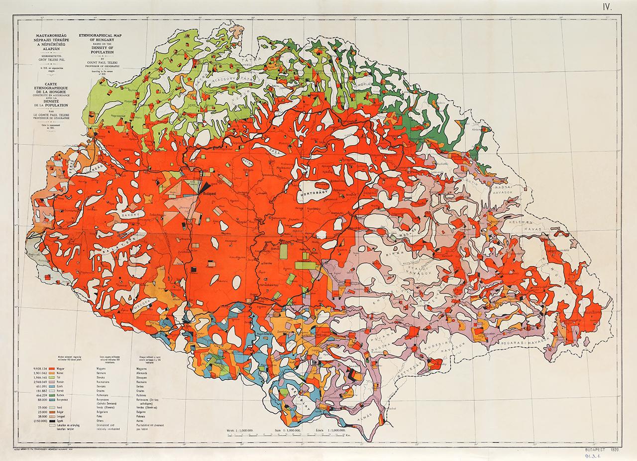
Map of ethnic conditions in the Carpathian Basin, prepared for the Paris peace talks by Count Pál Teleki, demonstrating how new borders imposed by force would ignore linguistic and ethnic boundaries. (1920)
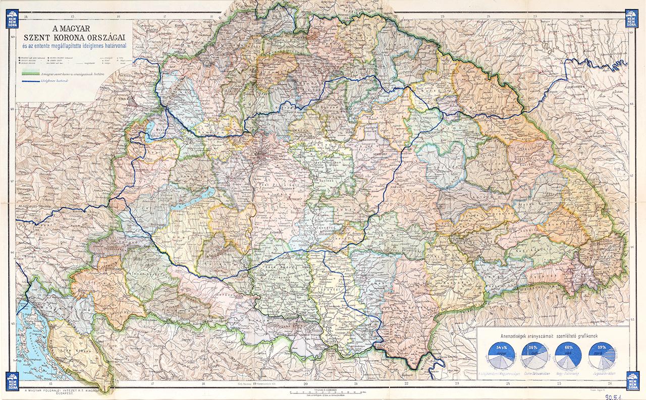
This map was drawn before the Treaty of Trianon, but it already shows the provisional borders established by the Entente Boundary Commission.
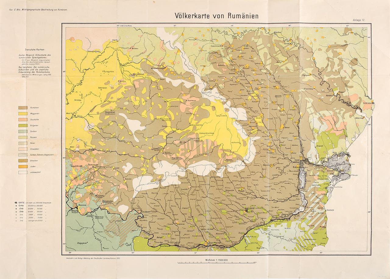
The map shows the ethnographic relations between Transylvania and the Romanian principalities.